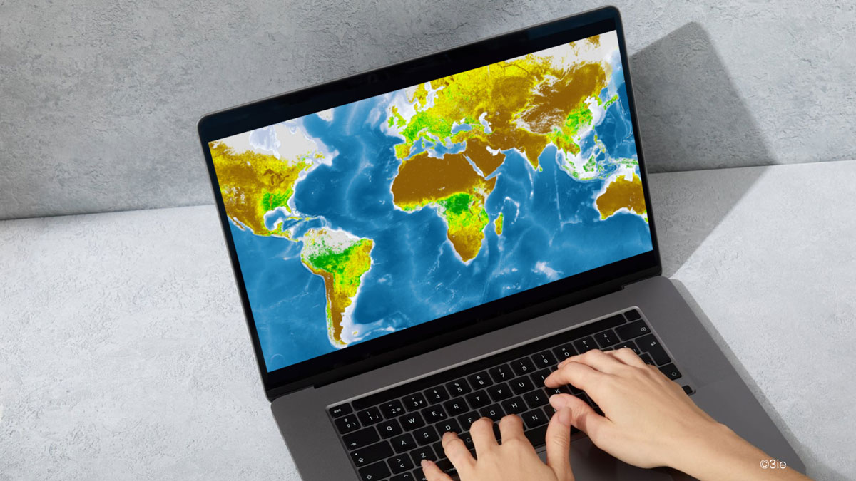
Imagine you are an evaluator trying to determine whether an agricultural intervention has increased vegetation in a dry, arid, and conflict-prone region—where on-the-ground data collection is challenging. You are aware that satellites can measure greenness from space using NDVI (Normalized Difference Vegetation Index)—a commonly used remotely sensed indicator. However, you are not sure whether this is a reliable measure and if so, how you could incorporate it. This highlights a key challenge: how can development practitioners leverage remote sensing to evaluate and strengthen programming?
While remote sensing offers significant potential for evidence generation, many practitioners lack the technical expertise to leverage these tools effectively. To address this gap, 3ie, as part of the Geo4Dev Initiative, has launched the ‘Remotely Sensed Indicators for Development’—a practical, user-friendly resource to help integrate remotely-sensed data into projects.
The case for remote sensing in development
Today, remote sensing is being leveraged in diverse and innovative ways alongside field data to evaluate outcomes. By combining remotely-sensed indices with machine learning and generative AI, researchers are measuring an even wider range of outcomes such as:
- Estimating poverty using nighttime lights and daytime satellite imagery
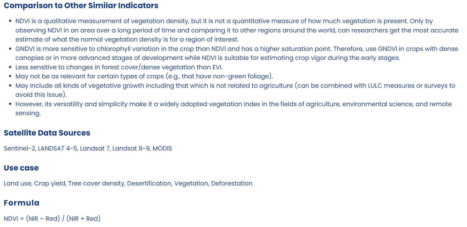
- Assessing agricultural productivity through vegetation indices like NDVI
- Measuring CO2 emissions and their health implications
These proxy indicators complement traditional field-based measures, offering scalable and cost-effective alternatives. Integrating remotely-sensed indices provides unique advantages, such as enabling large-scale evaluations and tracking changes over time. Recent blogs by J-PAL and 3ie underscore how these innovations are transforming the landscape of development evaluation.
Advancements in satellite remote sensing
The Earth observation industry is expanding rapidly, driven by advancements in space technology, cloud computing, and a wide array of new commercial and noncommercial satellites and sensors. While platforms like Google Earth Engine have improved accessibility of satellite data, open-source machine-learning models such as NASA and IBM's Prithvi (a geospatial foundation model), Meta's Segment Anything (SAM), and MOSAIKS have enabled precision in analysis of satellite imagery. These tools support tasks like:
- Land cover classification
- Object detection
- Temporal monitoring of changes, such as deforestation or urban expansion
This allows for detailed, reliable, and efficient analysis of large-scale spatial data.
Bridging the knowledge gap
Despite the advancements, a significant knowledge gap persists between the technical capabilities of remote sensing and the needs of development practitioners. Beginners and experts alike often struggle to navigate the wide range of remote sensing indices available, identify suitable indices for specific use cases, and understand methodological considerations for accurate application. This disconnect limits the integration of remote sensing into decision-making processes, which is exacerbated by the rapid pace of advancements in the field. By offering practical guidance and resources tailored to the needs of evaluators, researchers, and policymakers, 3ie’s new platform aims to close the gap.
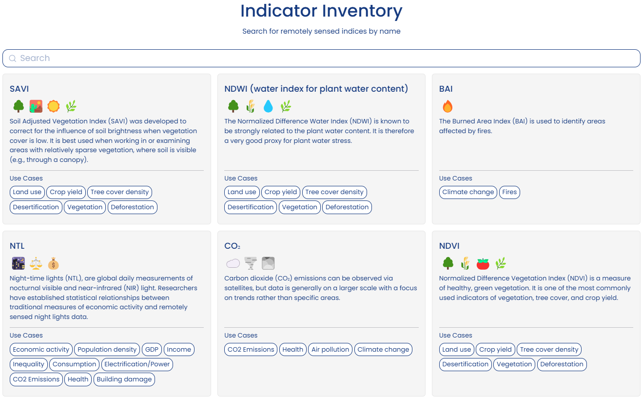
3ie’s new platform – an accessible inventory
Our ‘Remotely Sensed Indicators for Development’ platform provides an accessible inventory and guidance on using remote sensing data and indices across development sectors. The platform is designed to support a range of users. Whether you're an evaluator looking to use remotely sensed indicators in your evaluations, or a policymaker who wants to better understand and apply these for decision making, 3ie’s remote sensing inventory is designed to help users harness the potential of satellite technology for development impact.
Key features include:
- Comprehensive inventory: Descriptions of various indicators and their use cases
- Access to research: Methodological and empirical papers that utilize these indices
- Database accessibility: Filters to download geospatial data in multiple formats.
- Supplementary material: Links to additional resources for geospatial analysis, including training platforms (e.g., Geo4Dev) and tools for machine learning with geospatial data (MOSAIKS).
A collaborative, living public resource
This is a living public resource, and we welcome contributions from the community to help expand and improve its content. Researchers, practitioners, and experts are encouraged to reach out to us and share new indicators, methodologies, and case studies/papers to ensure the inventory remains relevant and up-to-date. These contributions will enhance the resource’s value and support the broader use of remotely sensed data in evaluations and policymaking. Explore the inventory today and become part of this exciting initiative.